by Louis E Roy, M.D.
In 1976, the late Louis E. Roy, M. D. wrote the following history of Big Alum Lake in response to requests from residents. Dr. Roy was the author of several historical publications and was a life-long summer resident.
“To write a vital history of an inanimate object is sometimes difficult, but not so with the subject at hand.
Whether we look at the legendary origin of “Pookhookapaug Pond”, or its geologic formation during the Ice Age some 10,000 years ago, each is romantic and intriguing in its own way.
First the scientific story…
When the Great Wisconsin Glacier began to recede northward from this portion of New England about 8000 BC, it left in its wake a tremendous alteration in the terrain and deposited many so-called “geologic boulders” on our lands.
The huge stones which seem to be strewn about haphazardly on our landscape were carried down from Northern Canada, Alaska and other northern points, and left behind when the ice melted. So, when you see these boulders that line the shores of Big Alum, such as the large one, fondly called “Table Rock” by several generations of children, and used by them as a play area near the Pratt home on the East shore, remember that you are looking at displaced works of nature, the great sculptor. They were put there as part of a larger plan for all of us to enjoy!
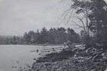
The process of shaping our lake involved erosion, cracking and splintering of large quantities of rock and movement of soil, with the resulting steep cliffs of Mt. Dan, deep water areas, a variety of beach areas from gradual sandy to sharp drop-off, and an obviously fertile top soil capable of nurturing an abundant flora and fauna. All of this adds up to beautiful Big Alum, a real jewel in the handiworks of nature!
The not so scientific legend of the origin of Pookhookapaug Pond is more enticing; Mr. Allen Faxon described it in 1900 (Courtesy of Emily B. Faxon):
The Legend
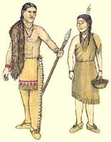
“On the hill at the north end of the valley where the pond narrows, there once lived a tribe of Indians. The sachem of this tribe was Nennepecannough, and he had a daughter whose name was Oolnah. It goes without saying that she was beautiful and of course she attracted the attention of many lusty young braves for miles around, any one of whom would have given all his wampum to carry off the coveted prize to his wigwam.
The young woman, like many other young women, spurned all advances. It looked as if she was doomed to become an old maid. But appearances were deceitful even at that time: she hadn’t met her fate. At last, however, a brave young scalper came out of the East to visit the sachem and patch up some kind of a treaty. This Indian’s name was Macondah. The story says that he put up overnight with the old chieftain. There was Oolnah. It was a case of love at first sight. Her heart was never her own after that.
When the time of Macondah’s departure arrived, when the feasts, dances and games were all over, and the princely ambassador of a powerful nation, with his retinue of braves was about to say goodbye, then the great scalp hunter Macondah stood forward and said, ‘Great father and chief of a nation of warriors! Macondah is about to depart to the land of his fathers, to say to them that he found the Mogansets with straight tongues, big hearts and open hands: that he ate with them, drank with them, and with them smoked the calumet of peace. Macondah is ready for his long homeward journey of many suns. But ere again his path again winds through the forest, he would crave a boon. While in the lodge of the great chief, his eye looked upon the comely form of Oolnah, whose voice is like the music of running waters. His heard has become soft as a woman’t toward the bright-eyed maid, and he would bear her to his distant lodge, to become the wife of one who will some day be proud and happy to lay at her feet the honors of a valiant chief.’
This speech did not seem to meet with favor, judging from the frowns of the other warriors who had also been suitors for the fair maiden’s hand. The chief read this frown and replied that the boon was greater than he could grant. Macondah was very much taken aback at this answer, and muttered something about being unworthy of so bright a destiny. He was turning away sad-hearted when Oolnah herself, who had overheard the conversation came forth stately and queenlike and standing between her father and her lover said, “The ears of Oolnah have been open: she has heard the brave Macondah crave a boon which the great chieftain of the Mogansets has declined to grant. Let Oolnah’s voice join with Macondah’s for she would go with him who would take away her heart. Macondah goes alone! Oolnah will never more hear the music of the birds, the breeze and the running streams, because there is no music for her who is without heart. She will nevermore behold the beauty of the heavens and of the earth, because there is no beauty for her whose heart is away. All music, all beauty, all joy are in the heart and Macondah has the heart of Oolnah.’
Thereupon, the chief called a council and had Macondah wait without. The young prince improved the opportunity to talk with his sweetheart and to lay plans for the future. The lovers feared an adverse decision. Accordingly they had resolved not to remain apart. If Macondah departed without Oolnah, he was to return at midnight, to the great spring by the oak, in the valley, where she was to meet him and they would join their fortunes forever.
The judges decided that the lovers must part, never to meet again on penalty of death. Farewells were said, and the warriors departed. But when they were outside the village Macondah shot a blood-stained arrow in the encampment as a sign the treaty was broken.
That night Macondah arose and stole back to the trysting place to meet his sweetheart. It was a pretty spot at the foot of a huge oak. Oolnah stole silently away from her lodge but was followed stealthily by a jealous rival, who had devined her purpose.
The lovers met by the spring, and rushed into each others arms. The rival ran behind Macondah and stabbed him in the back. Macondah fell dead. Oolnah uttered such a cry that the whole village was aroused, and rushed to the scene. They found the poor girl standing over the corpse of her lover holding the bloody knife. In a few solemn words she unbraided her father for his cruelty in seeking to separate them. Then with a cry to Macondah she plunged the knife into her own heart and fell back into the spring beside her lover.
While all stood aghast, rumblings were heard beneath, the earth heaved and shook, then opened and sank, taking all with it. The bright waters rolled over the fearful scene to wash away the stain of crime and blood.”
“This is the origin of Lake Pookhookapaug. I have never pulled up any tomahawks or bows and arrows when fishing to confirm the truth of this legend.” “A. H. Faxon”
To return to reality and recorded history, the first information which seems pertinent are the names of the local Indian chief and early white settlers in the immediate vicinity of the pond.
In 1644 the General Court of Massachusetts Bay Colony granted to John Winthrop, Jr. the right to mine silver from graphite ore at Tantiusques. The area was so named because it belonged to the sachem Tantaquieson or Tantaquidgeon (the latter spelling probably more accurate).
This mine was located in an area near what is presently known as Leadmine Pond. Eventually, Mr. Winthrop also purchased approximately 4 miles square of land around the mine. The ore was carried overland in barrels to Springfield, traveled to Boston by boat and then was shipped overseas to England for Processing. Assay of the ore yielded only 12 to 15 pounds of silver per ton and the project was soon abandoned. However, during the operation of the mine, a record exists of the first white man who resided in Sturbridge. He was William Diens, overseer at the mine. An invoice dated November 9, 1658 is still extant for supplies received by him on that day from a Springfield merchant, John Pynchon.

On September 27, 1655, Reverend John Eliot, the Apostle to the Indians, was given a tract of 1000 acres, near the west shore of Pookhookapaug Pond. Rev. Eliot is renowned not only for his apostalate but also for having translated the Bible into the Algonquin language. The local Indians, probably lesser sachems, who gave the land to Eliot, were Wattalloowekin (approximate meaning: ”turn of the water near the hill”) and Nahan (approximate meaning “island”.).
The plot was surveyed by John Chandler and the General Court confirmed the grant to the heirs of John Eliot in 1715. The pond is called Pookookappog on the official survey map of 1715. The proper spelling probably should have been Poohookapaug, which means “pond where we smoked tobacco.”
An engineering survey done in 1828 provides interesting information for conjecture about the hydrodynamics or “circulation” of the life blood of our subject. A map accompanying the survey report to the Massachusetts Senate shows our pond with the label “Allum Pond”. In local Indian parlance, that would mean “a dog”, but by 1828 the Indians had long ceased to be significant in the local population. (See Appendix D, Figure A-2). The survey was done in relation to a proposed canal to run from Boston to the Connecticut River by way of the Blackstone Canal, Quinebaug River, then at Sturbridge to South Pond, Podunk Pond and the Quabaug River. There was to be a series of locks to raise boats 22′ between the Quinebaug River and South Pond. The canal never materialized because of a simultaneous survey for a railroad proved more realistic and resulted in the Boston, Worcester and Western Railroads.
The map shows Allum Pond with a brook flowing south to the Quinebaug River and another coursing north to the Quabaug River by way of several small ponds in Brookfield. The relative elevations indicate that the water flow probably was in both directions away from Allum Pond, with the more rapid descent to the South. The northbound brook is the same one now called “Trout Brook”on modern geodedic maps and begins in a swamp behind the peninsula on the East shore.
Big Alum being a spring fed lake has a unique opportunity for regulating the quality of its water if only its residents will note the system set up by nature to drain away from the lake and not into it!. Probably an unusual arrangement, but one worthy of the memory of Oolnah and Macondah!
Beers Atlas of 1870 calls the lake ‘Alum Pond’. It shows Arnold’s Cove on the east shore, Fay’s cove on the north and Bemis cove on the south. Mt. Dan appears on the map. There is a sawmill shown on the outlet brook to the southwest, but no other brook is shown. There are no buildings on the lake.
The first evidence of usage of Alum Pond for recreation has been preserved permanently in a very interesting way. On the front lawn of the property presently owned by Dr. and Mrs. Louis E. Roy on “The Point” is situated a “geographic boulder” implanted into the soil near the northwest corner of the camp. On the flat surface, facing to the south, in letters deeply chiseled into the stone, is the following inscription: “CAMP KABIBINOKA 1874″. In the author’s recollection, this inscription has been there at least 50 years, and looked old even when he first remembers seeing it as a child. It is fair to presume that this was probably the first camp site on Big Alum. However, there is no evidence of a permanent building having been built on this site and the next few paragraphs relating to the first camping expedition, no mention is made of a previous campsite.
The first recorded camping expedition at Alum Pond is the following in the words of A. H. Faxon: ‘I recall how five of us tramped over from Spencer on the 2nd of July, 1890, to see Alum Pond. The day was hot and dusty and after our thirteen mile walk we were glad to sit down and eat our dinners. The first thing I did was to strip off and plunge into the cool, clear, water. We were a little disappointed in the size of Alum, and it had only one island. However, we decided to camp there, and selected the east side as the best place to pitch our tents.’
The five mentioned above were Allan H. Faxon, Charles E. Dunton, Lewis W. Dunton, Milleris W. Prouty and LeRoy Ames, all young adults at the time. Photographs were taken on the occasion.

The first permanent camp built at Big Alum was the Log Cabin “Camp Dan” started in 1890 by the five named persons in the original camping expedition, with the addition of Henry B. Montague and Lynus Bacon. Mr. Faxon and Mr Montague were later to be prominent in the community life of Southbridge. Mr. Ames was a professor at Clark University. The Dunton brothers, Mr. Prouty and Mr. Bacon were business men in Spencer and Boston. The cabin was built with logs made from pine trees cut from the west shore of the lake by a Mr. Adams. They were hauled by sled to his water-powered sawmill a short distance away on Brookfield Road on the other side of Mt. Dan. The construction was of squared logs and boards, and consisted of two rooms-one upstairs and one down. A picture shows it in its early days.”
Richards Topographical Atlas of Sturbridge for 1898 calls our lake ‘Pookookapog or Alum Pond. It also shows nine cottages, three of which are identified. The only one on the east shore is the one presently owned by the author, and listed as owned by ‘N. St. John’. There is one on the south shore, not identified. Then one just west of the present State lot identified as ‘S. F. Bemis’. Moving clockwise up the west shore are 6 others, the next two in order unidentified, then ‘G. H. Hartwell’ and then three more unidentified. (The last must be the log cabin, Camp Dan.)
By the year 1900 there were at least 16 cottages on the lake. By 1916, there were 35 and at the latest count in 1976, there are 149, of which, approximately one third are year-round residences. Let us hope that we have reached a plateau in quantity and now let us exert ourselves in endeavors aimed at maintaining the quality of what we have.
If this synopsis of the history of our rich heirloom has done anything to help make us more appreciative of what nature has bequeathed, then the effort expended has been worthwhile.”
Louis E. Roy. M. D.